Spatial Processing

Spatial Processing


Application of state-of-the-art technologies to derive environmental information from spatial data to be presented by business intelligence

Data Intelligence

Data Intelligence


The continuously growing amount of environmental data relies on new efficient ways of data storage & handling to make use of the information contained therein

Earth Observation (EO)

Earth Observation (EO)


Satellite and airborne derived data provide a wide variety of sources to get insight into the status and trends of the earth’s surface composition

Irrigated Fields

European Topic Centres

space4environment is a long-time member of the European Topic Centre Urban, Land and Soil systems (ETC ULS) which transformed into the European Topic Centre on Data Integration and Digitalisation (ETC DI) and was member of the former European Topic Centre on Biological Diversity (ETC BD). Our work in the ETCs spans over a very diverse range of thematic as well as technical subjects covering topics such as land accounting and ecosystem services to data flow management and application of technical solutions like data cubes, automated scripting and business intelligence.

read more
Ecosystems And Biodiversity

Ecosystems And Biodiversity


Ecosystems and biodiversity are under constant pressure. Holistic and systemic approaches are needed to protect and restore endangered species and degrading or degraded ecosystems.

Land Management

Land Management


The mapping of land cover (biophysical description of the earth) and land use (socio-economic functional dimension) is indispensable for assessing the impact of land management processes.

Policy Support and Project Management

Policy Support and Project Management


The implementation of policies requires ready-made information and knowledge products. Geospatial information is one solution for gaining this knowledge.

COP4N2k / EU Grassland Watch on Natura 2000 site (Lac du Salagou, France)

EU Grassland Watch

The EU Grassland Watch project and its predecessor COP4N2K is developing an unprecedented service to support monitoring and management of currently almost 3700 grassland-dominated Natura2000 sites by using Copernicus data. Producing very long time series of land use/land cover data changes (since 1994) for monitoring the development of those Natura2000 sites, biophysical parameters provided by means of semi-automated processing of Copernicus satellite and land monitoring service data are used to for the development and calculation of grassland status and change indicators. space4environment was in charge of the project lead, indicator definition and analysis, quality control of the EO products, and support to communications.

read more

latest news


11
May

space4environment met with partners in Bremen for the first large progress meeting of the Horizon Europe FAIRiCUBE in April

+ Read more

03
November

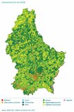
New report on land use and land cover in Luxembourg published

+ Read more

06
September

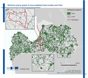
ESPON spin-off project on green infrastructure in Latvia successfully closed

+ Read more

About Us


Get to know space4environment, the team behind and our passion